ArcGIS GeoAnalytics Server 10.8.1 includes updates, enhancements, and bug fixes.
If you're upgrading to ArcGIS GeoAnalytics Server 10.8.1, you must reauthorize your software. You can obtain a new license file from My Esri.
Analysis tools
At 10.8.1, Geographically Weighted Regression has been added to the Analyze Patterns toolset. This tool uses a local form of linear regression that is used to model spatially varying relationships. The tool is available in GeoAnalytics Server.
At 10.8.1 enhancements to have been made to the Reconstruct Tracks and Find Dwell Locations tools to support determining the first and last value in a track. This enhancement is available in GeoAnalytics Server and the GeoAnalytics Desktop toolbox.
At 10.8.1 Find Dwell Locations has been enhanced to support a time boundary parameter. You can segment your data for faster analysis.
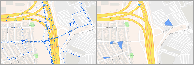
At 10.8 Find Dwell Locations has been added to the Find Locations toolset. This tool determines dwell locations from time-sequential points in a track. Dwell locations are defined as sequential observations with little or no movement over a certain period of time. Depending on the field of application, this may be referred to as stay points or idle detection. The resulting layer displays the dwell location as points, a convex hull of the dwell locations, or a mean centerpoint of the dwell. This tool is available in GeoAnalytics Server and the GeoAnalytics Desktop toolbox.
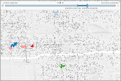
At 10.8 enhancements to Find Point Clusters have been made to include spatiotemporal clustering in addition to the existing spatial clustering. Spatiotemporal clustering discovers clusters of points that are in close proximity based on their spatiotemporal distribution. This enhancement is available in GeoAnalytics Server and the GeoAnalytics Desktop toolbox.
Data sources
At 10.7, GeoAnalytics Server added the capability to write analysis results to big data file shares. This included support for writing to a file share, HDFS, or Amazon Simple Storage Service (S3) buckets and Microsoft Azure Data Lake stores. At 10.8, this support has expanded to include Microsoft Azure Blob containers as an output big data file share location.
At 10.8, when writing to big data file shares, output big data file shares will have the dropSourceFields parameter set to true. This parameter can be modified in Server Manager on your GeoAnalytics Server by editing your big data file share manifest.